Our plots · Nilabadi (Neelabadi), Bandhugaon, Koraput
Agnigangamma Temple plot
A paddy plot traced from a marked map. Satellite photos, greenness maps, the crop's year month by month, a weak-patch check and a soil estimate.
Where
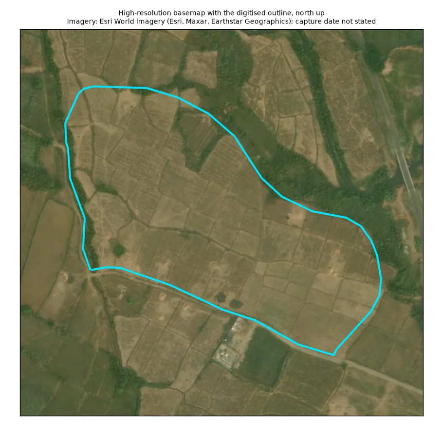
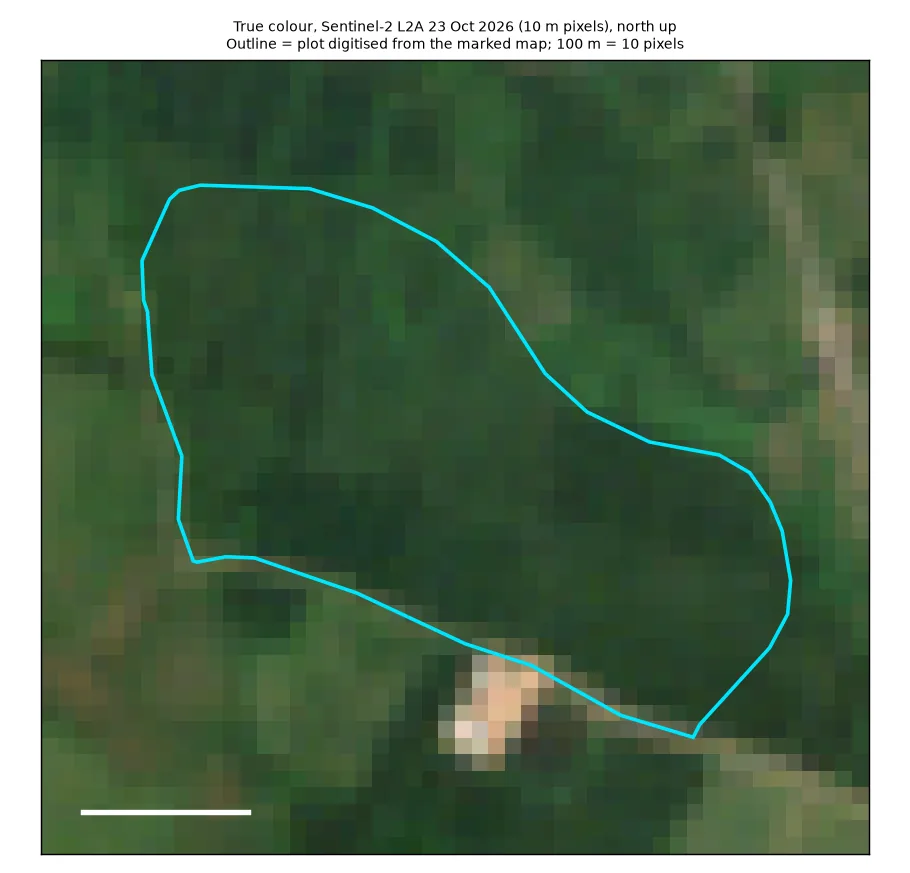
The exact plot
Traced from the map screenshot you marked. Each screenshot was fitted onto close-up aerial photos by matching roads, ponds and tree clumps, to within about 1 m (how this works). Only 10 m squares whose centre is inside the outline count towards the crop numbers.
| Field | Centre (map position) | Size | Number of 10 m squares | How sure we are |
|---|---|---|---|---|
| Temple plot (north of the road) | 18.96188 N, 83.26674 E | 7.47 ha 18.45 acres | 747 (682 fully inside) | Position: sure. Edges: fairly sure (traced from a hand-drawn ring; area could be about 10% off). It may cover more than one person's land. |
Crop health · greenness inside the outline
The crop's year, month by month
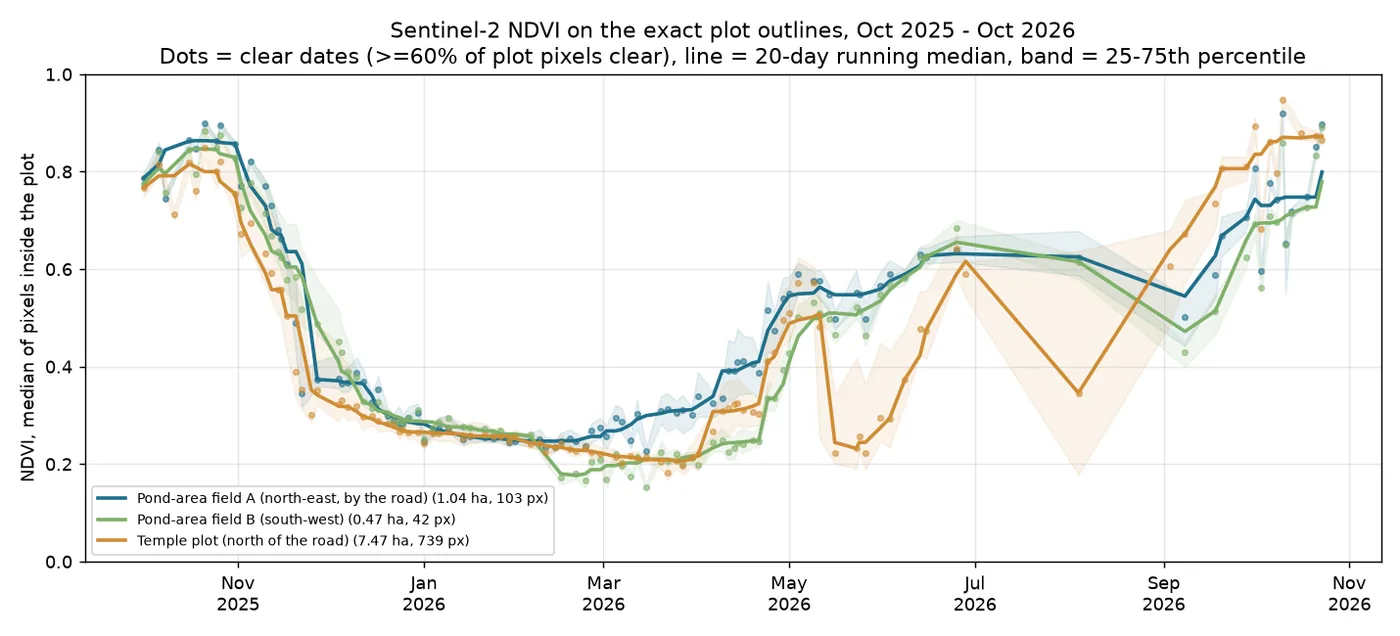
Built from 105 cloud-free satellite photos (at least 60% of the squares inside the outline were clear of cloud). The labels say what the greenness shows. They are not records of work done in the field. Seen by satellite Technical name: NDVI and phenology
25
25
25
26
26
26
26
26
26
26
26
26
26
How to read this: each box is one month, from October 2025 to October 2026. Its colour shows what the field mostly looked like from space that month.
| 2025 monsoon crop at its greenest (smoothed) | 0.82 on about 16 Oct 2025 |
| Ripening started: greenness fell below 0.7 | 2 Nov 2025 |
| Mostly harvested: greenness fell below 0.5 | 22 Nov 2025 |
| Lowest point in the dry season (smoothed) | 0.21 on about 25 Mar 2026 |
| 2026 crop half-way green (rough) | about 25 Jun 2026 |
| September 2026, middle value | 0.73 |
| Latest cloud-free photos | 16 Oct: 0.88, 21 Oct: 0.87, 23 Oct: 0.87 |
Harvested or ripening?
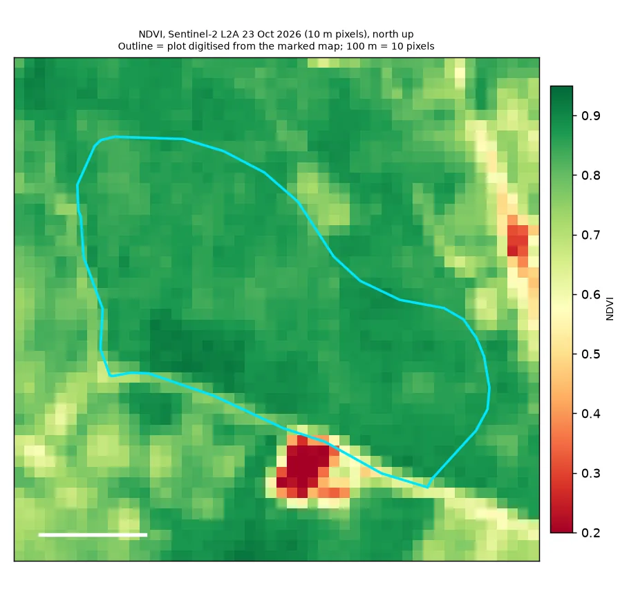
Not harvested. On 23 Oct the plot's middle greenness was 0.87, and 100% of its squares scored above 0.6. That is as green as it gets. In 2025 its smoothed greenness fell below 0.7 about 10 days before the pond fields.
The satellite also shows a short green spell in late April and early May 2026 (middle value up to about 0.57). It was gone by mid-May. It could be a summer crop, weeds or a seedling nursery. Only someone on the ground can say.
Inside the field · 10 m squares
Is any part of the field always weaker? Experimental
Each 10 m square fully inside the outline is compared with the field's middle value on the same day. This uses the cloud-free photos of 1–23 October, in both 2025 and 2026. A real weak patch would be low in both years.
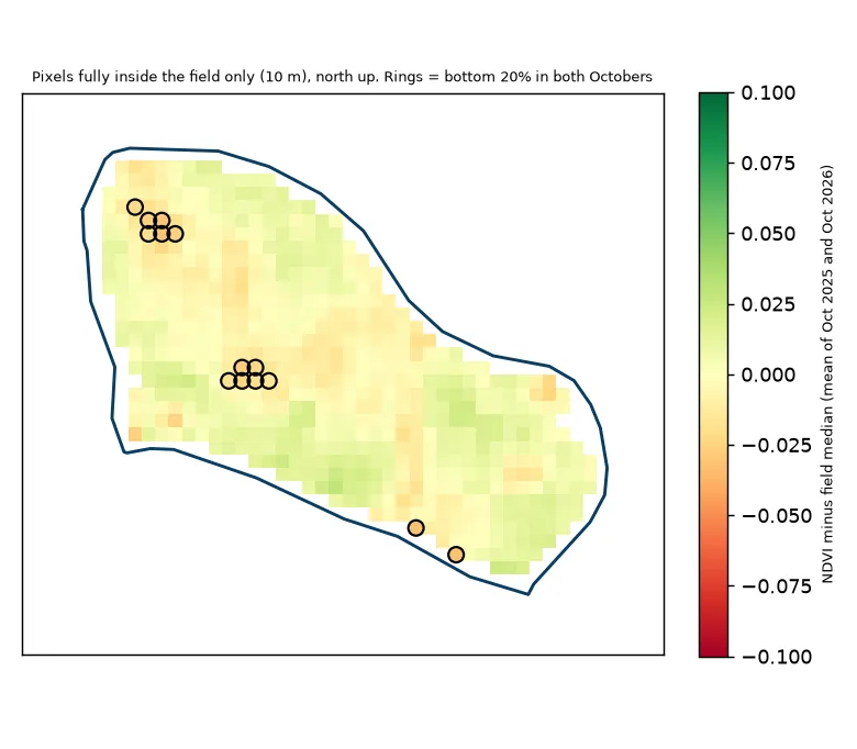
Result: no weak patch
- Temple plot (north of the road): 637 squares tested. Year-to-year match score: -0.32. 14 square(s) were in the lowest 20% in both years (2%, against about 4% you'd expect by chance).
The squares that were low in one year are not the ones that were low in the other. So FarmBot does not claim a weak patch. Technical name: weak-zone check with Spearman rank correlation
Soil · from a world soil map
What the soil is probably like Estimate
A slightly sour (acidic) clay-loam (a fairly heavy, sticky soil), with pH 6.2–6.3. (pH 7 is neutral; lower is more sour.) The values are read at the centre of the plot. They come from a world soil map that predicts soil on 250 m squares, much bigger than the fields. Get a Soil Health Card or a lab test before deciding on fertiliser. Technical name: ISRIC SoilGrids 2.0
| What | Top 5 cm | 5–15 cm deep | 15–30 cm deep |
|---|---|---|---|
| Clay (%; sticky, fine particles) | 27.4 | 29.2 | 32.6 |
| Sand (%; gritty, coarse particles) | 39.2 | 37.8 | 35.2 |
| Silt (%; smooth, middle-sized particles) | 33.5 | 33.0 | 32.2 |
| Sourness (pH) (scale 0–14; below 7 is slightly sour, or acidic) | 6.2 | 6.3 | 6.3 |
| Organic matter (carbon) (grams per kg; from rotted plants; more is better) | 28.2 | 17.1 | 11.5 |
| Total nitrogen (grams per kg; a main plant food) | 1.9 | 1.57 | 1.06 |
| Nutrient-holding power (a lab unit, cmol(c)/kg; technical name: CEC) | 19.4 | 17.5 | 17.2 |
| How tightly packed (grams per cm³; technical name: bulk density) | 1.3 | 1.31 | 1.36 |
Please read with care
- FarmBot is an experiment. For now it uses satellites only. Always trust what you see in the field first.
- The field outlines are traced by hand, not surveyed. They were drawn from the maps you marked and lined up with close-up aerial photos (to within about 1–2 m). The edges are right to about 5–10 m.
- The photos are coarse. Each 10 m square is one dot of colour. The two pond fields hold only about 100 and 40 of these squares, and many mix in bunds and the next field. So detail inside a field is only a rough hint.
- Clouds hide the monsoon. In July and August there were only one or two cloud-free photos. So the satellite can't tell when transplanting happened.
- Soil and weather numbers are computer estimates, not measurements on these fields. Areas are approximate.