Nilabadi (Neelabadi) · Bandhugaon · Koraput
Village snapshot
Official 2011 records plus a 2.2 km satellite view. The full village-wide view is coming soon.
Official records
Nilabadi in numbers
From the Census of India 2011 village records and the Local Government Directory, via Odiapedia. These figures are from 2011 and may have changed.
2,123
people in 476 households (Census 2011).
511 ha (about 1,263 acres)
village area; about 416 ha (about 1,028 acres) net sown, 173 ha (about 427 acres) irrigated from canals (Village Directory).
Paddy
main crop listed, followed by lemon grass and cotton. Government village code (LGD) 428775, Neelabadi gram panchayat.
Satellite snapshot · 2.2 km box
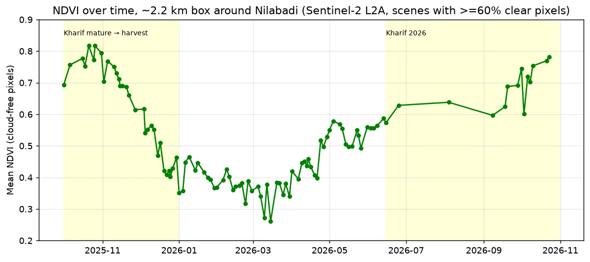
Green now, brown in March
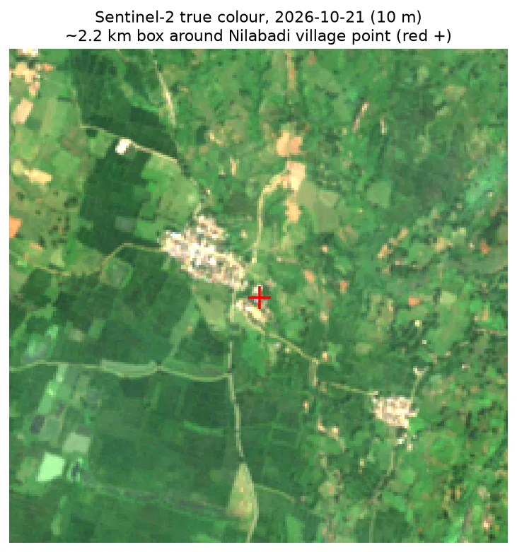
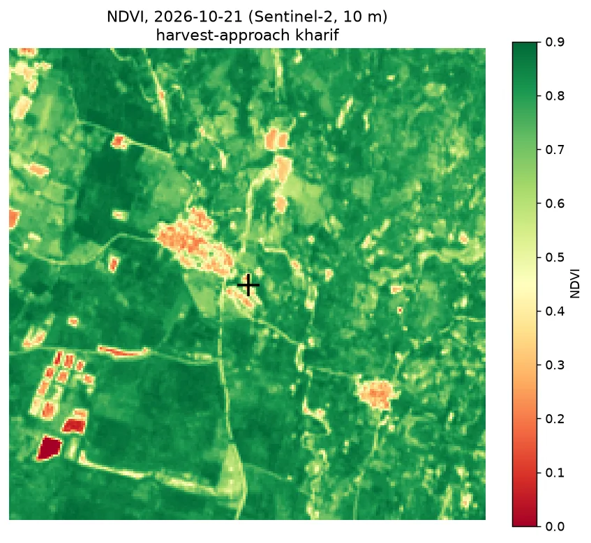
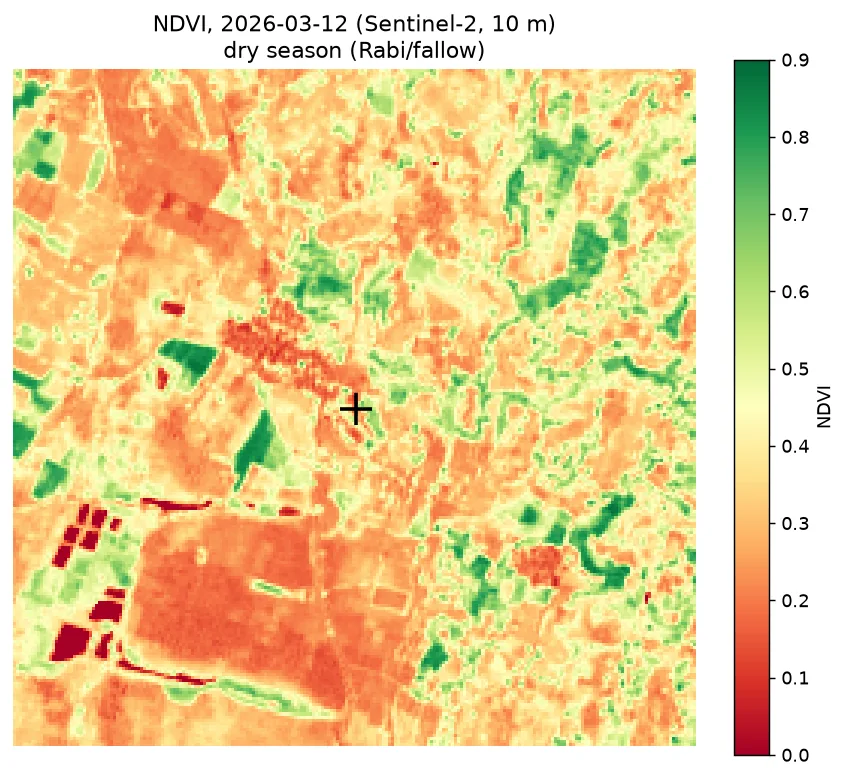
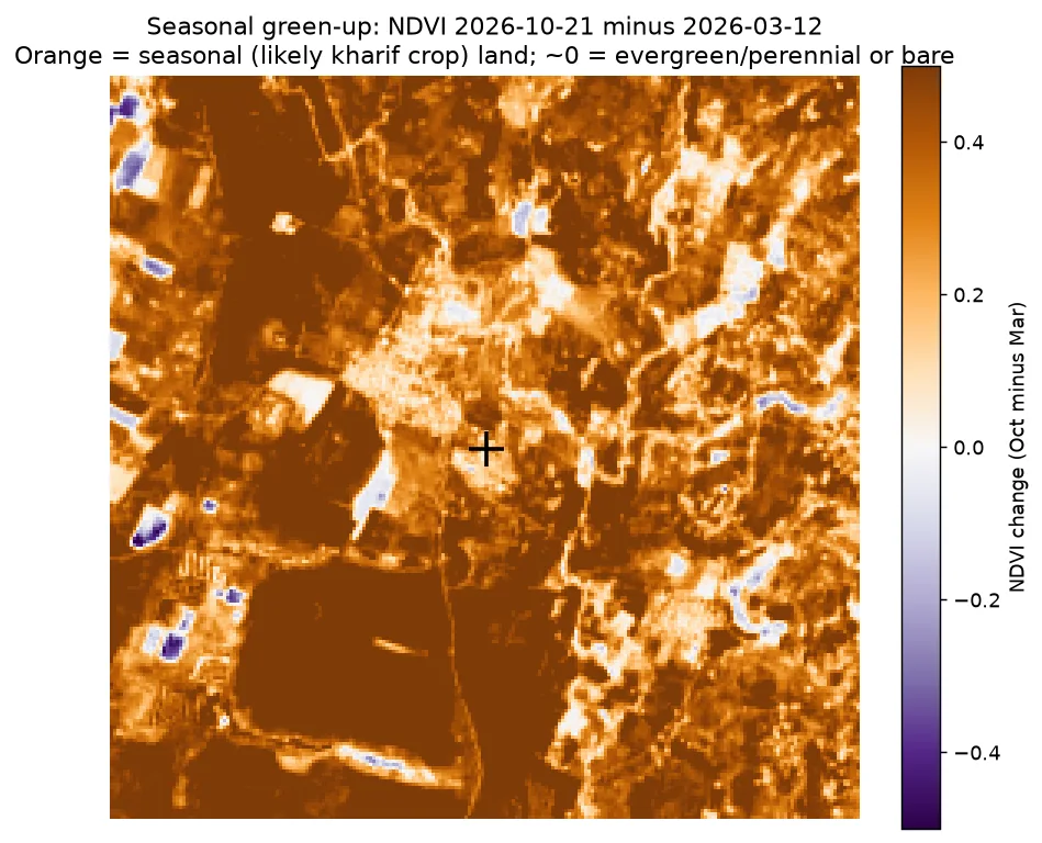
Across a 2.2 km box around the village point, mean greenness score (NDVI) was 0.77 on 21 Oct 2026 (96% of squares above 0.5), against 0.37 on 12 Mar 2026 (18%). 74% of the box gains more than 0.3 greenness between the dry season and the monsoon. That is the signature of a single rain-fed monsoon (kharif) crop. Seen by satellite
Land cover · 2021 European map (WorldCover)
About half cropland
| Class | Share of 2.2 km box |
|---|---|
| Cropland | 48.8% |
| Tree cover | 29.1% |
| Grassland | 20.3% |
| Built-up | 1.7% |
| Water | 0.1% |
This land-cover map (WorldCover) is from 2021, at 10 m detail, so it doesn't reflect later changes.